After requests we previously published as draft overview of bicycle infrastructure in Dublin. It was requested by visitors to the city involved in cycling who want to check out a sample of what Dublin has to offer, usually people involved professionally or with cycling advocacy.
This is not a normal tourist map.
...I'm sorry to disrupt you while you're reading this article, but without messages like this, IrishCycle.com's reader-funded journalism won't survive. With nearly 1/2 million views and 300k readers so-far this year, it's not just people who are dedicated to cycling that this website reaches. However, the number of subscribers is around 0.6% of readers. While having a large gap between readers/subscribers is standard for non-paywall reader-supported journalism, IrishCycle's journalism needs more support. Don't delay, support monthly or yearly today. Now, back to the article...
And it shroud be noted that this is just a quick update to that draft guide. This is just a sample of the cycling infrastructure in Dublin. There is lots more cycle lanes and paths of varying quality in Dublin. Although this map lists most of the higher quality routes of note.
Blue = overall reasonable to good quality route along roads.
Brown = routes of mixed quality but noteworthy due to volume of people cycling or attempts to fix the route.
Green = greenway (note: may include restrictive barriers).
Red = sections of contra-flow routes.
Purple = Mystery cycle route
DublinBikes
Where: Stations across the city centre. Quality: High
What: It’s one of the most successful bicycle share systems in Europe, more details here. It’s not a cycle route but it is cycling infrastructure which has done more for acceptance of cycling and promotion of everyday cycling than most routes so-far (but most routes are poorly designed or disconnected or non-continuous).
Grand Canal Route (inner section)
Where: Mainly along the Grand Canal between Portobello and Grand Canal Square
Quality: Mixed
What: The first notable attempt at on-street segregation in Dublin City Centre. It’s a two-way route which travels along the canal bank and beside one-way streets, two-way streets and pinch points with shared use where there’s little room between houses and the canal. It gets very busy at rush hour and is the only route we know of in Ireland which has large-scale use of mini-bicycle traffic lights. It runs into the Dublin Docklands and connects with the first (and very small) section of the Royal Canal Route which is in sections both under construction and in planning from Dublin to Galway on the west coast of Ireland.
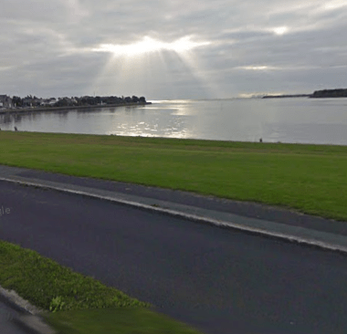
S2S north
Where: Along Dublin Bay from Eastpoint Business Park / East Wall Road to Sutton.
Quality: Good to mixed
What: The northside section of cycle route along Dublin Bay. The northren half of the route was joined up in the last few years but it is awaiting a connection to the city centre and onto Sandycove in South Dublin.
Braemor Road cycle route
Where: Braemor Road, Churchtown
Quality: High
What: In the suburb of Churchtown, the 2km section of route upgrade is noteworthy because it has gone from being one of the worst in Dublin to one of the best. It’s now includes mostly 2 meter cycle paths in both directions. The cycle path is wide, near-continuous, and smooth. The transitions between cycle path and cycle lane at junctions and other locations are almost unnoticeable. The widths provide for easy overtaking of single cyclists, and Dutch- or Danish-like social cycling beside your friends or family. If it only had bus stop bypasses, it could have been world-class.
Blackrock bypass upgrade
Where: Frascati Road and Temple Hill in Blackrock, south Dublin
Quality: ReasonableUpgrading route which was very poor for cycling to one which is of a reasonable quality. It includes Danish-like raised cycle paths but fails on poor junction treatment and the lack of bus stop bypasses. It’s worth looking at the ‘before‘ and ”after‘ images on Street View to see what it look like before.
Tallaght to Templeogue Route
Where: Templeogue Road from around Cheeverstown House Public Swimming Pool to Main Street in Tallaght
Quality: Good / reasonable
What: Good example of two-way cycle path besides large route, upgrade of the M50 ring road underpass ramp and
upgrade of part of Main Street in Tallaght to (somewhat) Danish-like cycle tracks. Some problematic bits but overall good. Like most cycling infrastructure in Dublin, the main flaw is it not being connected to much.
Irish Museum of Modern Art route + Inchicore Road contra-flow
Where: Military Road entrance of the museum to Inchicore Road.
Quality: Mixed
What: A route (shared with people walking) along the Irish Museum of Modern Art’s park-like grounds and onto a two-way cycle lane, including a contra-flow cycle lane on Inchicore Road. The route strangling leaves you cycling with-flow on Inchicore Road to the right of motor traffic.
Since first having this on the list, a project outside Kilmainham Gaol gave significant amount of space from cars over to the public space. However, that project made the route more confusing and more disjointed for cycling.
Phoenix Park cycle paths
Where: Main avenue and branches
Quality: Good long uninterrupted stretches close to city centre, but poor junctions and links
What: Cycle paths running the length of Dublin’s main park. Stunning views and leisurely cycling. Mind the odd walker who thinks the paths are footpaths or shared use — they are not supposed to be, but remember it is a park.
N11 route
Where: N11 and “detrunked” sections of the same route (Stillorgan Rd to Leeson St)
Quality: Mixed, very poor to good
What: A mix of cycle lanes, bus lanes, and cycle paths. Includes recently installed bus stop bypasses. Revamped sections in recent years means the overall quality of the route is improving but it might take some time yet before the overall route quality is improved. Some good examples of bus stop bypasses but some poor examples of them too and many poor junction treatments.
Grand Canal Route (outer section)
Where: Black Horse Luas stop to Adamstown
Quality: Mixed overall because of many restrictive barriers, but good surface
What: Greenway between Blackhorse and Adamstown — to be joined up with Grand Canal Route mentioned above. Note: Image includes construction van, this is normally a route free from cars and vans. But don’t be surprised if you see a moped or even a horse and beware of people congregating around barriers etc.
Windy Arbour Luas contra-flow and UCD Dart to Luas route
Where: St Columbanus’ Road, Dublin
Quality: Mixed
What: Part of the Luas (tram) – University College Dublin – Dart (suburban rail) route.
Blackrock contra-flow
Where: Main St / Newtown Avenue, Blackrock
Quality: High
What: Contemporary contra-flow cycle path. Would be better if it was continued onto Main Street, but when built it represented a rare Dublin example of a high quality contra-flow cycle path.
Bull Alley Street contra-flow
Where: Bull Alley Street, Dublin
Quality: Good
What: Contra-flow cycle lane example with toucan crossing over main traffic route.
Royal Canal Bank contra-flow without lanes
Where: Royal Canal Bank, Phibsboro, Dublin
Quality: Works well, but poor surface
What: Rare example of contra-flow cycling without a lane or path using “no entry, expect cyclists” signs. Acts as bypass of very busy streets. Also see: North Leinster St which is a nearby more recent version of the same.
River Liffey mini-greenway plus Irish National War Memorial Gardens
Where: Along the south bank of the River Liffey at the Irish National War Memorial Gardens
Quality: Mixed
What: A route which could be a lot better for little money by removing restrictive barriers.
Northstrand Road – Fairview route
Where: Northstrand Road, Dublin
Quality: Poor.
What: The second busiest route for cycling entering Dublin City Centre has narrow shared bus lanes. It’s very poor. Due for upgrade. Number of bicycle users likely due to a number of main routes converging into one near the city centre.
IMAGE: Cyclists from Rathmines heading towards South Richmond Street
Rathmines Road
Where: Rathmines Road
Quality: Mixed to poor but noteworthy
What: The busiest route for cycling entering Dublin City Centre has cycle lanes narrow shared bus lanes. It’s poor — the cycle lanes are often blocked by parked cars.
Grove Road
Where: Grove Road, Dublin
Quality: Poor but noteworthy
What: Poor quality only made half decent because the traffic is usually heavily congested at peak times where more bicycles clear junctions than cars do. Includes bicycle counter (newer version installed since the above photo was taken).
Ryder’s Row / Capel Street contra-flow
Where: Ryder’s Row / Capel Street
Quality: Mixed
What: Contra-flow in the city centre with the recent addition of “Orca” dividers to seprate the cycle lane from traffic (not pictured).
...That's the end of the article. Keep scrolling if you want to the comments, but IrishCycle.com *NEEDS* readers like you to keep it that way. It only requires a small percentage of readers to give a bit each month or every year to keep IrishCycle.com's journalism open to all. Thank you.
You should have the Royal Canal included, from North Strand Road up to Drumcondra road- hard surface, narrow underpasses at the bridges,
From Cross Guns Bridge up to Castleknock – hard surface, 4 kissing gates, narrow parts near Broombridge
yeah in fairness, plenty of paint in use but segregated lanes are at a minimum. Drumcondra in-bound and out-bound are not too bad south of Fagan’s pub. Towards Finglas out-bound is pretty bad with some bad cyclelane on footpath type planning. Overall you wouldn’t be letting a kid cycle into town
At first glance it looks like there’s a nice blue route almost all the way from Sutton to Rathmines. However, I have to take great exception to the Grand Canal Quay section (between Pearse St and Lower Grand Canal St). Have you ever tried cycling on it? It’s cobblestones, worse even that a badly painted bus lane/cycle track. Even the StreetView shows cyclists going on the path instead.


You should have the Royal Canal included, from North Strand Road up to Drumcondra road- hard surface, narrow underpasses at the bridges,
From Cross Guns Bridge up to Castleknock – hard surface, 4 kissing gates, narrow parts near Broombridge
North of the liffey not getting much of a look-in here.
Not a huge amount of infrastructure on the northside — I was going to add the Finglas Road as a poor example but ran out of time last night.
yeah in fairness, plenty of paint in use but segregated lanes are at a minimum. Drumcondra in-bound and out-bound are not too bad south of Fagan’s pub. Towards Finglas out-bound is pretty bad with some bad cyclelane on footpath type planning. Overall you wouldn’t be letting a kid cycle into town
At first glance it looks like there’s a nice blue route almost all the way from Sutton to Rathmines. However, I have to take great exception to the Grand Canal Quay section (between Pearse St and Lower Grand Canal St). Have you ever tried cycling on it? It’s cobblestones, worse even that a badly painted bus lane/cycle track. Even the StreetView shows cyclists going on the path instead.
https://www.google.com/maps/@53.3406095,-6.2393738,2a,75y,146.51h,82.15t/data=!3m6!1e1!3m4!1sTWmYF-sDrDK9ZICWjQVGxQ!2e0!7i13312!8i6656
I’d add in the Firehouse Knocklyon section Dodder of the Greenway, which is pretty good.