

COMMENT & ANALYSIS: For the record, I recently made a personal submission on CycleConnects covering Ballina and some areas around it. For transparency, I might as well post it here and be clear that Ballina is my hometown and where I live.
It includes a few things I’ve written here before. It’s also a bit rushed — if it wasn’t as rushed I’d likely have looked more at the what I call below the “potential links currently not shown on network map” — these kind of links are more deliverable in the short-term. These could be added together with existing and other planned infrastructure faster than many of routes listed in the draft CycleConnects map.
Anyway, here’s the submission:
The CycleConnects Route Classification in the route technical notes is key to reading the maps:
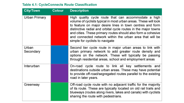
Primary, secondary and greenway are what people might think they would be.
Interurban is a bit more complicated: “On-road cycle route to link all key settlements and destinations outside urban areas. These may have potential to provide off-road/segregated routes parallel to the existing road in later years.”

At this stage of the draft, comparing the maps for Mayo towns and this description is a matter of concern because:
- Routes within Ballina linking to high employment, schools, large housing estates etc have been marked as “interurban” even within urban areas. But these need segregation in the short-term and clearly should be part of the primary urban network.
- Where back roads are used, segregation will not always be the preferred option. It’s standard across Europe to use lower-traffic rural roads like this, sometimes with extra measures.
- Mention of segregation without also mention of the option of low-traffic roads and a mix of both should be avoided as it implies segregation is the only way to provide such routes.
- A cycle network for a market town really needs to stretch beyond its urban boundaries to clusters of housing, villages etc. Where segregation is needed to the next town or village etc, this cannot be long-fingered if you want to build a truly useful cycle network for towns, especially Market Towns such as Ballian, Castlebar and Westport.
Given the above, a mix of the description and classification should be changed.
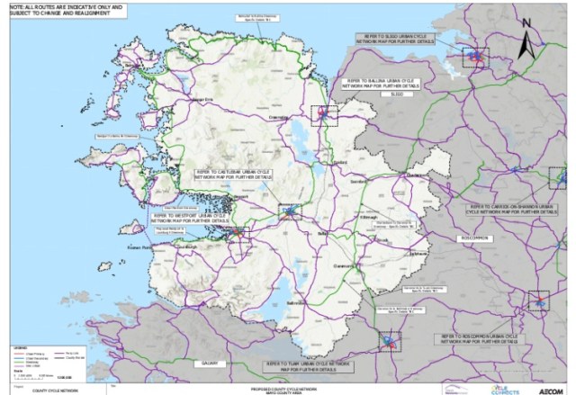
Scale used on maps in urban networks on Mayo network
There’s a known issue with the boundary the CSO uses for the population in Ballina (see: CSO confirm Ballina’s population has increased, not deceased, Mayo News). But even without taking that issue into account,l Ballina (population 10,171) and Castlebar (12,068) are largely comparable, and Westport is notably smaller in population size and far more compact, so there’s something wrong with the map scale used:
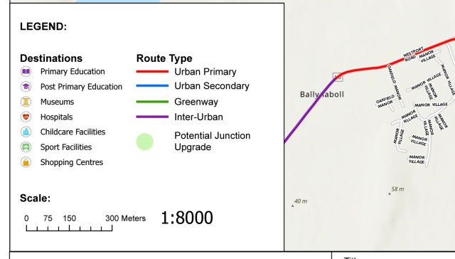
- Castlebar — 1,8000
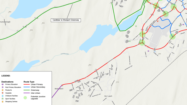
- Ballina — 1:5500
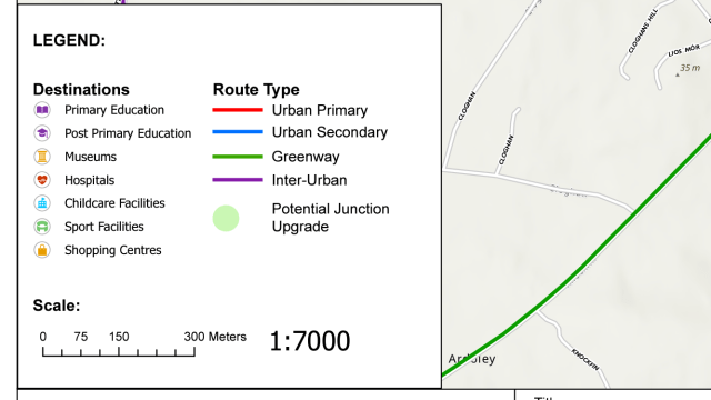
- Westport — 1:7000
Screenshots showing scales used in each town.
Castlebar:
Ballina
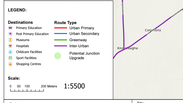
Westport:
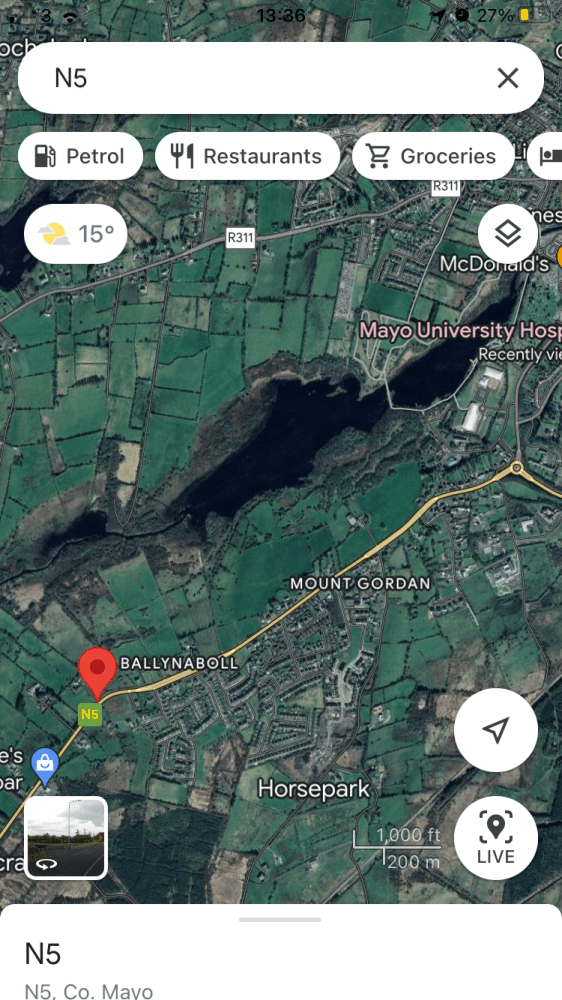
This is the primary route marked on the Westport Road in Castlebar — and a satellite with the red marker showing where it ends:
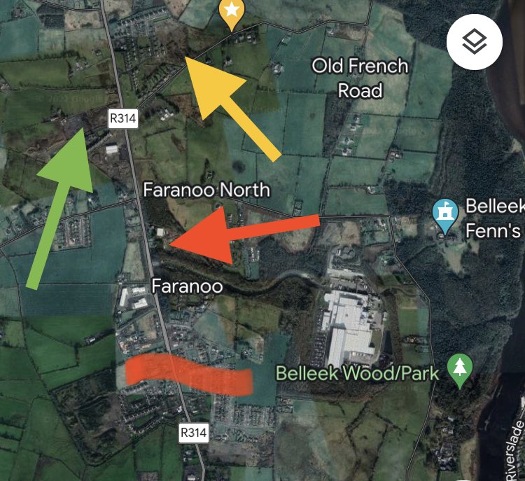
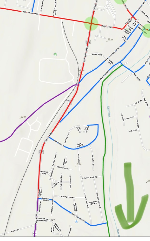
Meanwhile on the Killala Road in Ballina (disclosure: it’s where I live), everything above the red line is excluded and is wrongly marked as a inter-urban route:
- The Coca-Cola factory, which is one of Mayo’s largest employers (access at red arrow).
- An existing school and a larger replacement school which is being built across the road (green arrow).
- A large housing estate (yellow arrow), four smaller housing estates, and a number of clusters of housing along the main road or beside the estates.
- A few other businesses.
On the other side of Ballina, another part of the urban area is cut off from:
- Hollister factory, another of the largest employers in the county.
- A housing estate and clusters of housing.
- A number of other buildings.
- Another school (although this school is a distance outside of the urban area, it still serves the town and is cyclable from the nearby estates).
There are other issues such as not including other obvious potential links in the plan.
Greenway starting point at Belleek Woods
The greenway starting point in Belleek Woods is by the river, the line marked is the road into Belleek Caste and not the greenway. The secondary route here misses the soccer, club, a tourist attraction etc.
Interurban route to Knockmore
The interurban route to Knockmore follows the main road exactly, there is an alternative which uses are relatively quiet section of back road which could allow the road to bypass the section of the main road which has little space and join up the sections which as more space.
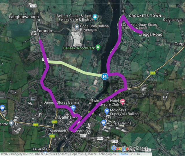
Lack of route between Killala Road – Belleek Woods – Quay areas
Such a route between Killala Road, Belleek Woods, and Quay areas would require a new bridge over the River Moy but such a walking and cycling bridge has been long called for and identified as a having transport, tourism and health.
A route like this would link to schools, areas of employment, residential areas, sports clubs etc on both sides of the river.
At least some people in Ballina have called for a walking and cycling bridge between Belleek Woods and the Quay area of Ballina for years — it would be good for not just tourism and leisure but also for walking and cycling as transport.
It would enable children and teenagers on one side or the other to access nature and play areas, a playground, pitches, a track, and schools, without having to take a longer trip by car.
Many of these trips are “parent taxi” trips which often include the parent dropping the child or teenager off and returning home or driving elsewhere for the hour of the sports practice etc — ie double trips by car. With the new bridge, walking and — more so — cycling would often offer a quicker alternative to the car than even where parents accompany the child (ie for younger children) there is a time saving for cycling compare to driving via the town centre.
For older children and teenagers it would be a core part of a safe and attractive connection to friend’s house on what is now the other side of the town.
For adults it would offer quicker routes from the Quay and Downhill areas to the Killala Road, ie to workplaces such as Ballina’s largest employer, Coca-Cola. And would also be a route between residential areas and make it more attractive to go for a walk in the woods or use sports facilities without getting into their cars.
As part of a wider network, it would offer benefits for tourism, leisure and transport along a green route around the town and as a way to connect hotels to the Belleek Greenway / Ballina to Killala Greenway and eventually be a node for longer-distance greenways which are planned or proposed.
Compared to the existing walking and cycling bridge to the south of the town centre, the proposed bridge near the Quay and the woods would be further away from Ballina’s two historic bridges. This means it would have a stronger case to act as an alternative to driving. As a side note: The use of the existing walking and cycling bridge is also likely underestimated by many people.
Connections to/from the bridge would also have to be looked at, including a walking/cycling connection to the Killala Road area of the town (a project which would have benefits as a standalone project).
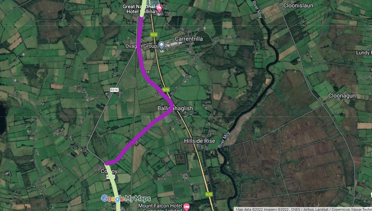
Here are some examples of its usefulness in offering an alternative to walking and cycling — often in cities cycling is faster, but this is usually not the case in towns. So, the bridge is an opportunity to give cycling an advantage for many trips.
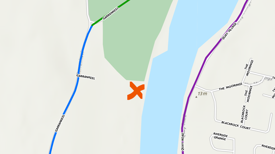
The Quay to the Belleek Woods / Athletics Track / Ballina Town FC

The Quay to Ballina Beverages Coca-Cola
The shorter green line is to the rear entrance (would need to have Coca-Cola on board for walking and cycling access and likely need planning permission for change of use to rear access).
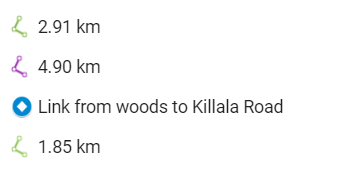
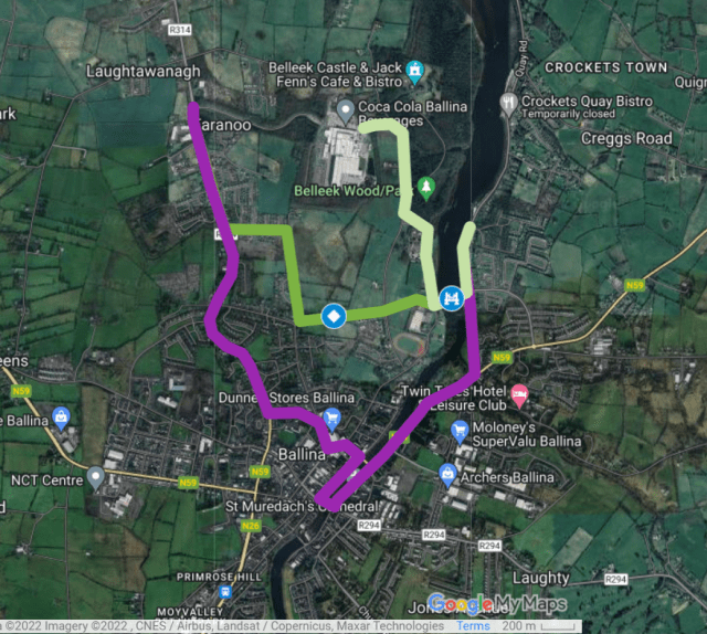
Downhill Inn area to the Belleek Woods / Athletics Track / Ballina Town FC:
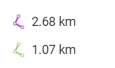
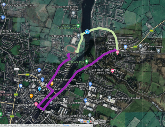
Killala Road to Ballina Rugby Football Club:
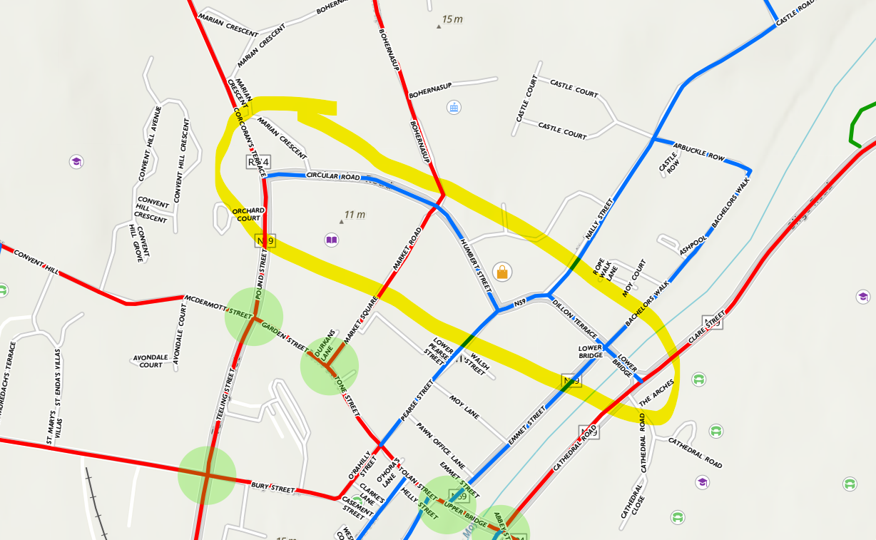
Choice of primary and secondary routes within the town centre
While many roads and streets are marked as primary (sometimes in close proximity to each other), others are not. This is the case even when some examples such as Circular Road, Humbert Street, and Dillons Terrace connect to more trip attractors (Lidl, Tesco, Dunnes, Department of the Environment offices, two secondary schools on the east side of the river etc) and might be more deliverable due to more space generally.
Equally, the greenway along the River Moy to the south of the town has a higher potential for transport cycling given that it connects to large housing estates and, can easily be connected to the largest one of the largest employers in the town, yet, this route and all the connects to it are marked as secondary:
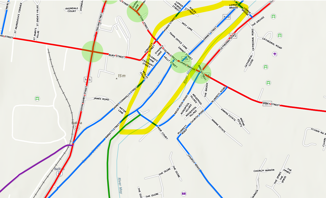
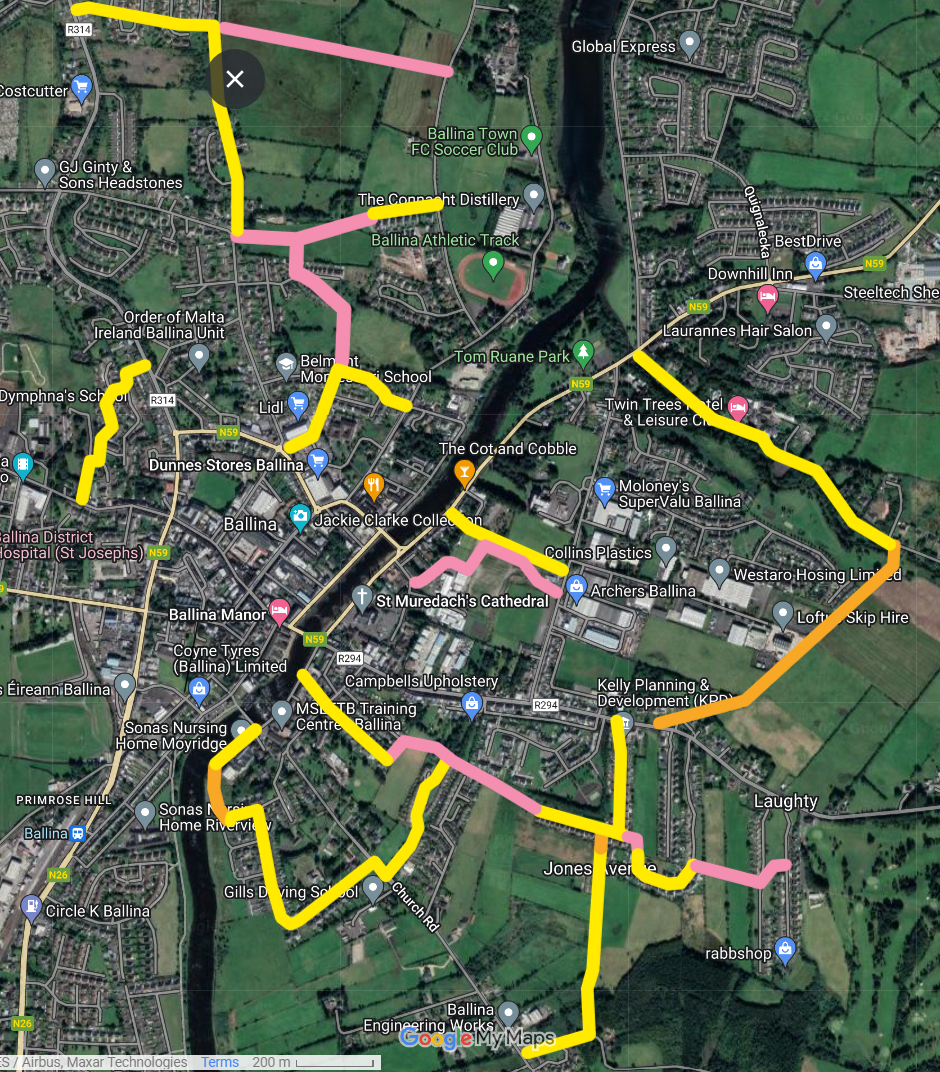
Potential links currently not shown on network map
These are mapped out below as follows:
- Yellow: Existing hard surface (streets, roads or shared paths) which could be upgraded, including resurfaced, traffic-calming, filtering, a crossing at a busy road at one end or both, or even just signs and markings.
- Orange: Existing path with non-bonded surfaces in need of upgrading.
- Pink: Potential walking and cycling paths or shared paths. Land acquisition is partly/fully required and/or waiting for development and make a condition of planning.
Some of these sections of routes – would be more easily built or improved compared to some of the routes marked as primary routes
...That's the end of the article. Keep scrolling if you want to the comments, but IrishCycle.com *NEEDS* readers like you to keep it that way. It only requires a small percentage of readers to give a bit each month or every year to keep IrishCycle.com's journalism open to all. Thank you.