

Comment & Analysis: The following is a proposal for a Killala Road Safety and Accessibility Scheme which I am sending to my local politicians today — I’m posting it here to get it out to the wider public, and for feedback.
Background and introduction
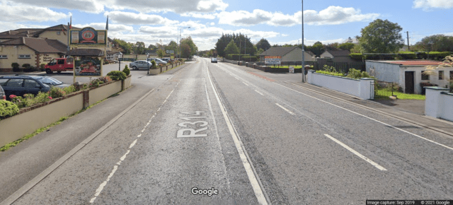
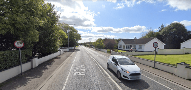
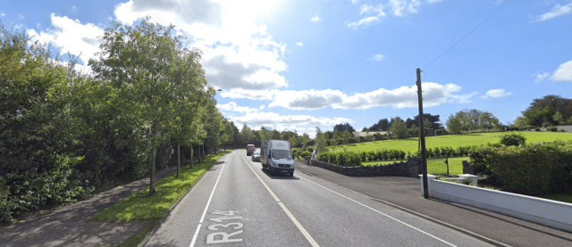
The Killala Road in Ballina is a regional road which is lined with houses and houses estates, it has heavy traffic. It has been subject to the linear development of houses and housing estates along the road.
This development of houses and industry has not been supported by basic infrastructure to make roads safe such as raised pedestrian crossings, and segregated cycle paths, which combined would act as appropriate traffic calming to deal with the deadly speeding which residents, employees and visitors have to put up with. The speeding issue is well known but little has changed in the design of the road in decades.
The Killala Road and Pound Street combined have one primary school at each end – Culleens National School at the northern end and Gaelscoil na gCeithre Maol in the town centre. In the centre is also the Mulberry Tree, a large childcare and after-school facility. The new entrance to St Mary’s Secondary School is also on Slí Ectra, which is a link road off the Killala Road, and the Killala Road is the route to other primary and secondary schools in the town.
Coca-Cola is one of Co Mayo’s largest employers and ratepayers. It has a significant effect on the road with approximately 330 car parking spaces, a high volume of HGV (heavy goods vehicle) trucks and a high volume of service vans.
The road is mainly residential in nature but also has a number of other businesses along it and just off it, including Costcutters supermarket, The Merry Monk, Max Tyres, McVann Furniture, Quinns Veterinary Surgery, Merricks Hardware, Hackett Commercials, Belleek Park Caravan & Camping, Liam Walsh Agricultural Consultants, and three fuel depots. The road is also part of the Wild Atlantic Way which pushes up traffic in the summer month. There is also other HGV traffic from quarries etc north of the town.
The current road, at different times of the day, has:
- (1) a large volume of traffic to schools and commuters to Coca-Cola, making it very hard for people to cross the road, especially children and elderly people.
- (2) a high volume of speeding making the road unsafe for all road users.
The need for change:
- The road is unsafe for all road users.
- The road is especially unsafe and inaccessible to people who want to or have no other option to walk or cycle.
- There is no pedestrian crossing of the road anywhere from the Leigue Cemetery to Killala.
- The road is highly inaccessible to children and people with disabilities.
- People who live just minutes away from a shop or a friend’s house on foot often currently drive due to safety concerns.
- Walking and cycling access needs to be improved, especially for new Culleens NS.
- More houses is likely but any bypass or relief road will likely take 10-15+ years.
Proposals would include:
- Adding pedestrian and cycle crossings at a number of points along the road.
- Reconfiguring existing cycle lanes and other available space to provide a two-way cycle path on one side of the road.
- Reconfiguring junctions and adding traffic calming to make it safer and easier for all road users, including motorists trying to turn in and out of side roads.
Funding
The Government is currently looking to spend nearly €1 million per day on walking and cycling infrastructure. Ballina should use this opportunity. This type of suggestion is ripe for gaining funding from National Transport Authority.
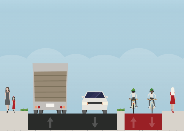
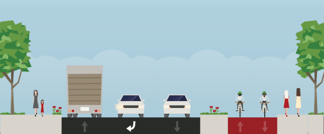
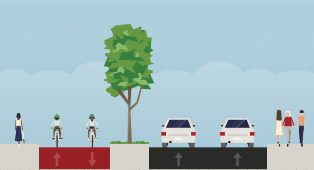
Two-way cycle path suggestion
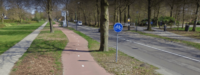
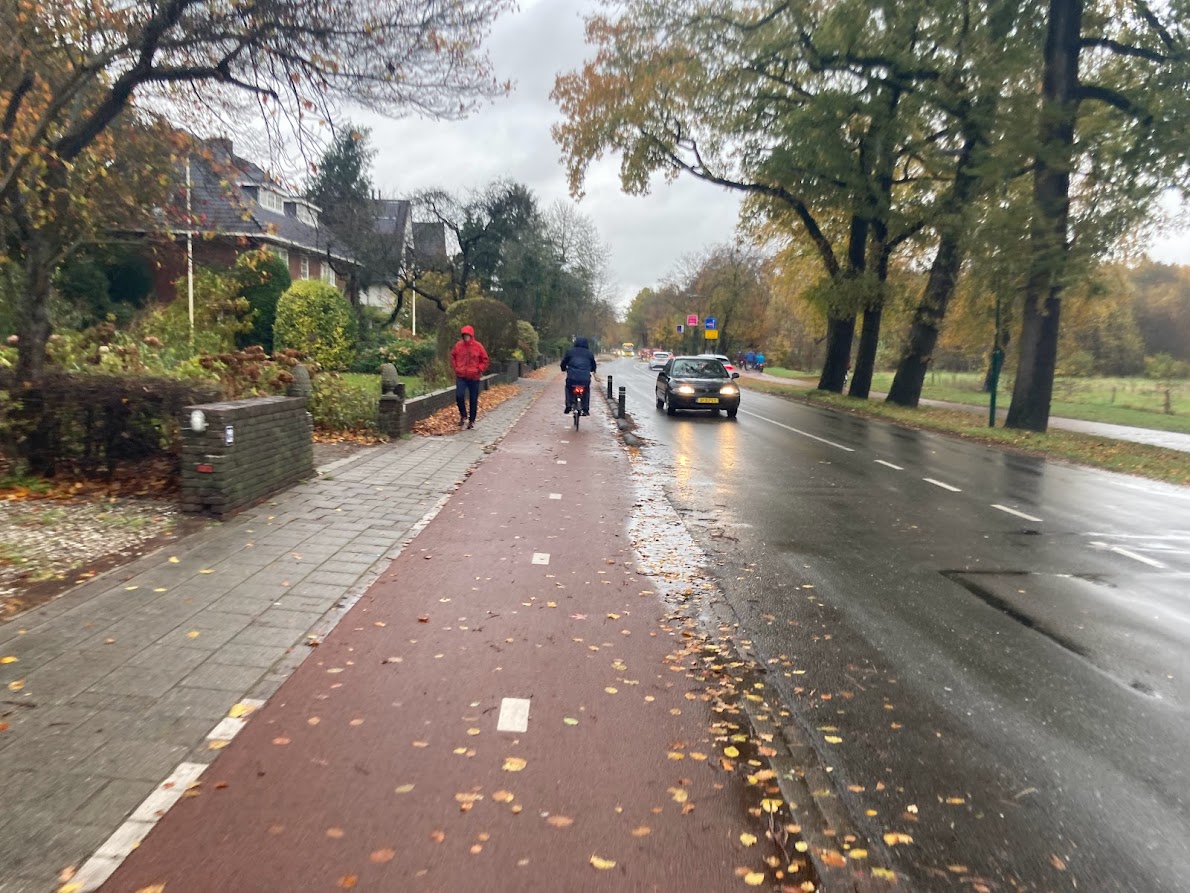
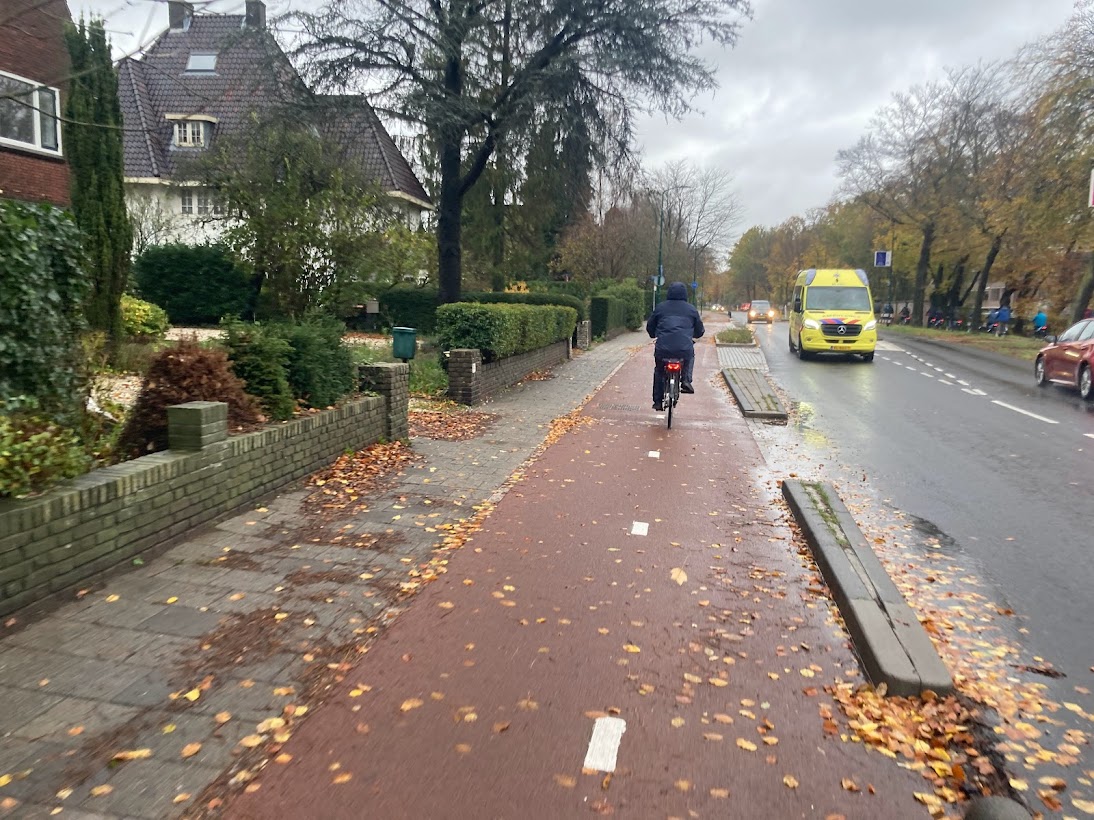
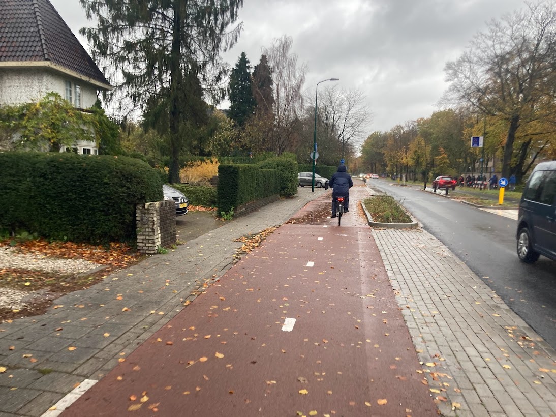
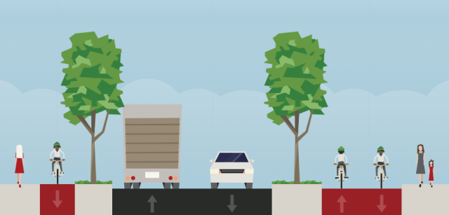
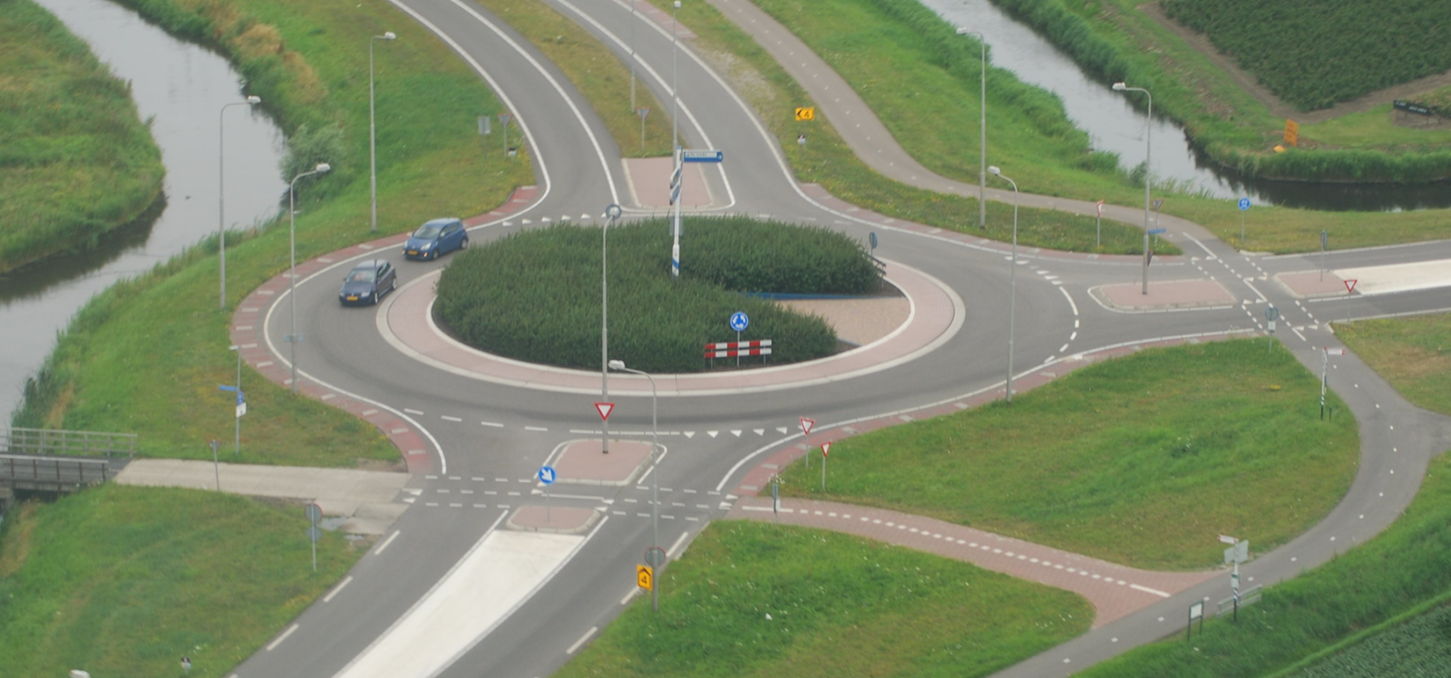
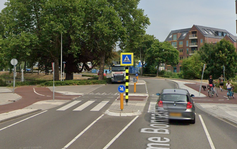
Two-way cycle paths have their advantages and disadvantages — here’s an example of one at the edge of the Dutch town of De Bilt. The first image shows a pinch point and the second image shows what can be done on a wider section. This is relevant to the Killala Road as will be explained below but the two-way cycle path example in De Bilt crosses driveways and is in a broadly similar context t the Killala Road:
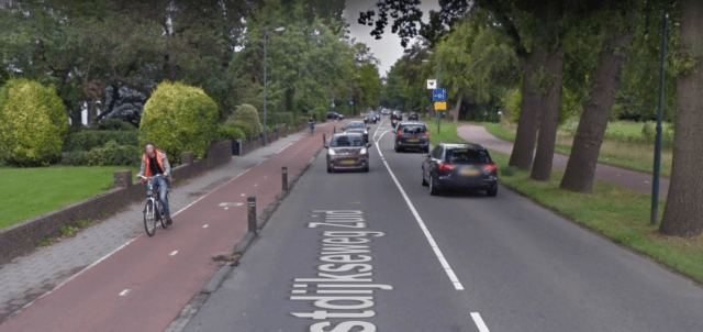
Photographs of pinch-point of De Bilt example:
Two-way cycle path separated by bollards and kerbs from carriageway:
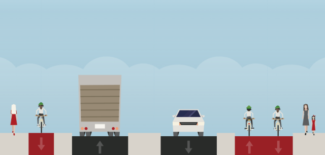
Space at driveways to allow access around pinch-point section:
Transition to a wider section:
Driveways at wider section and the final image from De Bilt:
Example two-way cycle path beside driveways in Utrecht:
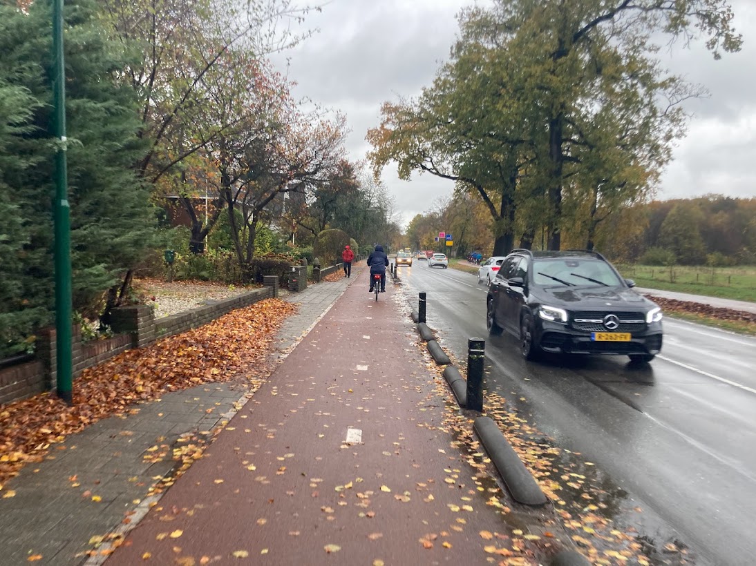
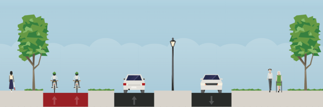
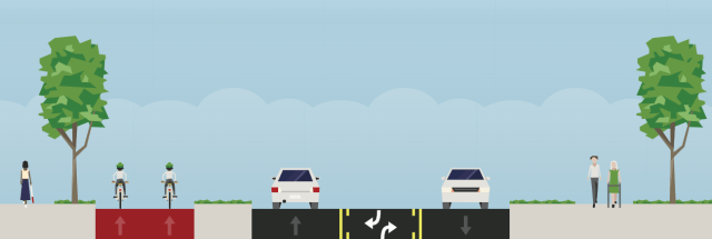
Two-way quick-build cycle path by DLRCC at Carysfort Ave showing driveways:
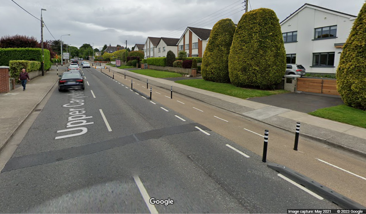
Two-way quick-build cycle path by DLRCC at Carysfort Ave showing minor T-junction:

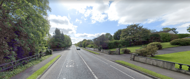
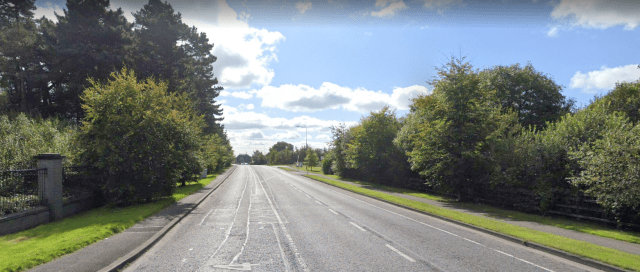
Here are the different sections of the Killala Road, split up here into sections by their general width (within these sections the width varies somewhat):
Culleens NS to Belleek Crossroads (333m)
Current
Suggested
Possible traffic calming/crossing with central refuge (trees would be visible here but not shown in the image)
Possible roundabout at Culleens NS / Oaklawn
Even if the council wants to continue to treat the area at Culleens NS / Oaklawn as a higher-speed road, there is still a requirement to make the road safer for people crossing it.
Currently, parents, children and others have to run across the road – a central median would allow the crossing point to be safer and more accessible.
Short narrow section south of Belleek Crossroads (127m)
Current
Suggested
Coca-Cola and Killala Road Business Park section (329m)
Current
Suggested
A central median could also allow for a crossing at this point for staff of Coca-Cola cycling and walking to work.
Possible alternative: Addition of a unidirectional cycle path on the Coca-Cola side as far as the cross-over point (see next page).
Cross-over of two-way cycle path
It is desirable to have the two-way cycle path on the side of the new school of the Killala Road but to cross over point to the other side of the road where the is fewer access points (ie driveways etc).
The cross-over point could be at the Killala Rd Business Park or at the Merry Munk, for example:
South of Killala Rd Business Park to Ashbourne Grove (173m)
Current
Suggested
Ashbourne Grove to Castlefield Manor, pinch-point (331m)
Current:
Suggested

Please note: The barrier shown above is what was available in the image drawing software, a combination of the bollards and kerbs in the De Bilt examples would be more suitable.
Castlefield Manor to Bohernasup / Leigue Cemetery (433m)
Current
Suggested
Wider area at Costcutters / The Olde Mill Stone
Current
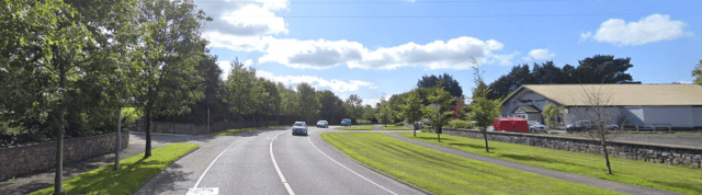
Suggested allowing for walking and cycling crossings with refuge area:
And also short turning lanes into Costcutters and housing estates
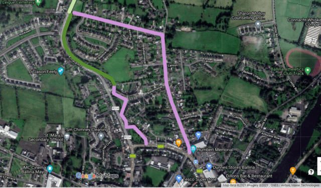
Leigue Cemetery to town centre
Between Leigue Cemetery and the town centre there are two route options — on the left below is a continuation along the Killala Road to and, on the right, is via Bohernasup. If not in the short-term, in the mid-to-long-term both of these options will need to be looked at.
Currently, on this section of the Killala Road there is only a cycle lane in one direction and it’s narrow, often driven in, and up against a wall at one point. While Bohernasup is a local residential road is has turned into a rat run in recent years.
Options include:
- Stringent traffic calming on Bohernasup to make it only attractive as an access route.
- Making Bohernasup one-way with a two-way cycle path.
- ‘Filtering’ Bohernasup at some point using bollards to block through traffic, residents would have access by car to all areas.
- ‘Filtering’ Bohernasup at some point using a one-way filter with traffic lights to discourage through traffic. The filter should include cycling ‘bypass’.
- Making both the Killala Road and Bohernasup one-way with two-way cycle paths and improved pedestrian environment.
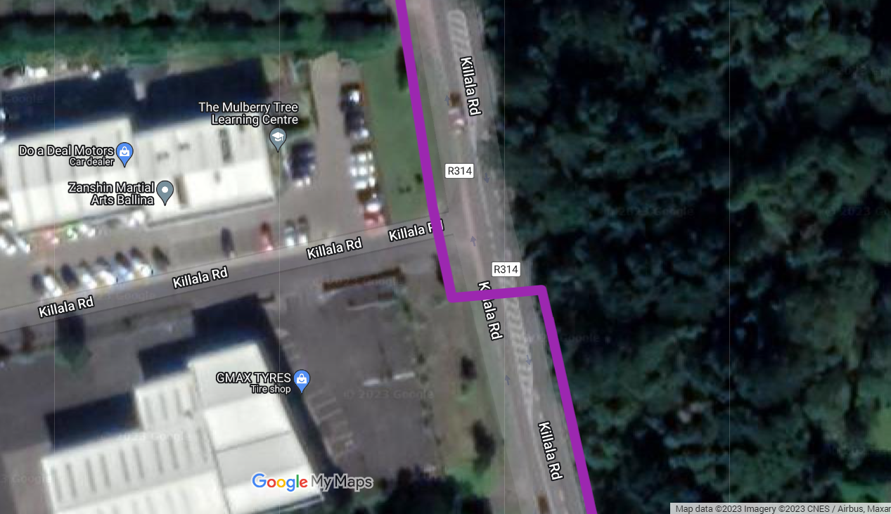
- Continuation along the Killala Road using the large amount of green space on one side of the road and a greenway-like routing can be used (darker green line in the map below) and this would lead into existing low-traffic residential streets (shown in purple).
Regardless of which option is chosen a link to the cycle paths on Slí Ectra (link road) is needed. This should include a reconfiguration of the Slí Ectra/Killala Road junction to make it safer for all road users.
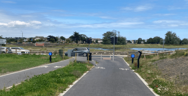
If the greenway option was developed, the urban and downhill nature of the section means it is important to look at separate paths for walking and cycling. There are a number of examples of these kinds of paths, one recent one in Ireland is the Baldoyle to Portmarnock Greenway with separate paths for walking and cycling:
Phased delivery
The above suggestion, besides the greenway element, can be delivered by the council using Section 38 of the Road Traffic Acts as amended by the Public Transport Act. The greenway element would need a Part 8 proposal.
The project has the potential to be delivered in phases:
- The Culleens NS to the crossover point (at Killala Rd Business Park or Merry Munk)
- Crossover point to Leigue Cemetery
- Leigue Cemetery to town centre
Given the advancement of the building of the new Culleens NS, section 1 above should be built as soon as possible
...That's the end of the article. Keep scrolling if you want to the comments, but IrishCycle.com *NEEDS* readers like you to keep it that way. It only requires a small percentage of readers to give a bit each month or every year to keep IrishCycle.com's journalism open to all. Thank you.
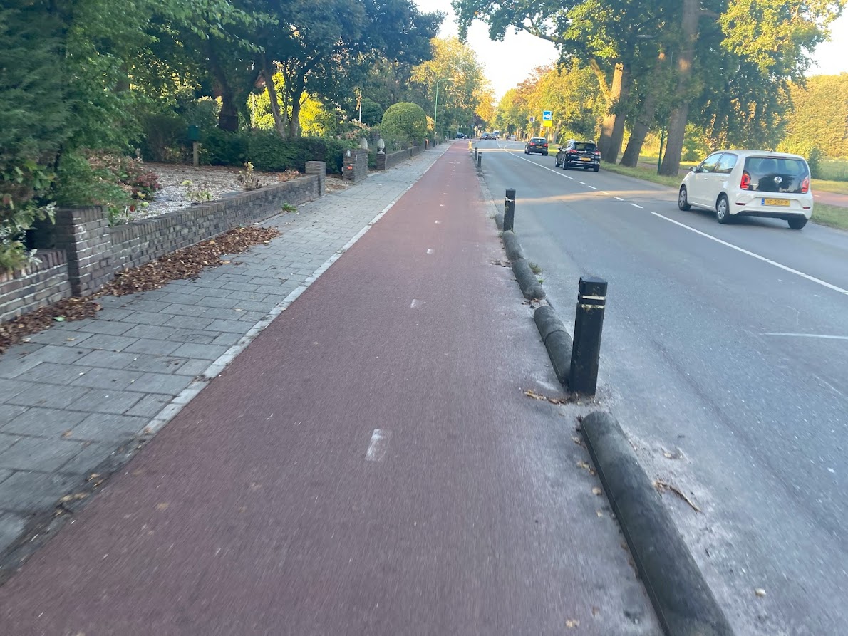
The Carysfort Ave scheme pictured above was looking great until DLRCC installed the bollards down the middle of the cycle track. They are a hazard to cyclists. Do we really need to be concerned about people inadvertently driving on the cycle track when they are coming in and out of their own properties that we need to coral them past the cycle track – is the road layout that confusing? In Holland there are generally no bollards in the centre of 2-way cycle tracks – older cycle tracks used to have them, but it can be seen on Streetview that bollards and splitter islands have mostly been removed from older 2-way cycle tracks in Holland (evident by the patch repair on the pavement). So, the Dutch design approach is to avoid putting in barriers and retain a generous opening to all cycle tracks – yes wide enough to drive through but the overall gain in a cycle track uncluttered with potential hazards outweighs any perceived concern about people driving on it. Could DLRCC please remove the bollards on Carysfort Ave and designers, try using Google Streetview and look at what Holland is doing.